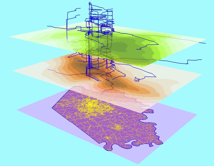
What is the UGCoP?
The uncertain geographic context problem (UGCoP) was first articulated in Kwan (2012a,b). It refers to the problem that findings about the effects of area-based attributes (e.g., land-use mix) on individual behaviors or outcomes (e.g., physical activity) could be affected by how contextual units or neighborhoods are geographically delineated.The problem "arises because of the spatial uncertainty in the actual areas that exert contextual influences on the individuals being studied and the temporal uncertainty in the timing and duration in which individuals experienced these contextual influences" (Kwan 2012a, 959).
As no researcher has complete and perfect knowledge of the "true causally relevant" geographic context, no study that uses area-based contextual variables to explain individual behaviors or outcomes can fully overcome the problem.
As discussed in Kwan (2012a), the UGCoP poses serious inferential challenges and is thus a fundamental methodological problem.
The UGCoP is different from the MAUP
While it seems similar to the modifiable areal unit problem (MAUP), the UGCoP is actually a different kind of problem because it is not due to the use of different zonal schemes or spatial scales for area-based variables. Instead, it is due to the use of arbitrary areal units for deriving area-based variables because of the lack of knowledge about the precise spatial and temporal configuration of the physical and social factors that exert influence on the individual behavior or experience under study.Methods for addressing the MAUP do not necessarily solve the UGCoP.
Unlike addressing the MAUP, where the primary analytical task is to identify the best areal division, neighborhood size, or geographic scale as well as to compare the effects of different zoning schemes and scales on analytical results, addressing the UGCoP involves more accurately measuring and estimating the "true causally relevant" geographic context.
The UGCoP is not relevant to area-based outcomes
Much of social science research is concerned with the relationships between area-based contextual variables and area-based outcome variables (e.g., cancer or crime rates of census tracts).The analytical focus of this kind of studies is group behaviors or outcomes (based on area-based data). It is not clear how group-based geographic context can be conceptualized given the spatial and temporal uncertainties of the true geographic contextual for each individual in a group.
Since individuals who live in the same areal unit (e.g., census tract or block) may experience contextual influences from many different areal units besides their home neighborhoods (since they may visit many different places in their daily lives), it is not clear how a true causally relevant geographic context may be meaningfully conceptualized or delineated for an area-based group (e.g., for all the individuals who live in the same census tract).
References
-- Please see the following articles for an in-depth discussion of the UGCoP:Kwan, M.-P. (2012a) The uncertain geographic context problem. Annals of the Association of American Geographers, 102(5): 958-968.
Kwan, M.-P. (2012b) How GIS can help address the uncertain geographic context problem in social science research. Annals of GIS, 18(4): 245-255.
-- Articles that corroborate or extend the UGCoP argument:
Chen, X., and M.-P. Kwan (2015) Contextual uncertainties, human mobility, and perceived food environment: The uncertain geographic context problem in food access research. American Journal of Public Health 105(9): 1734-1737.
Christensen, A., C. Griffiths, M. Hobbs, G.Gorse, D.Radley. (2021) Accuracy of buffers and self-drawn neighbourhoods in representing adolescent GPS measured activity spaces: An exploratory study. Health & Place 69: 102569. https://doi.org/10.1016/j.healthplace.2021.102569
Helbich, M. (2018) Toward dynamic urban environmental exposure assessments in mental health research. Environmental Research 161: 129-135.
Huang, J., and M.-P. Kwan. (2022) Uncertainties in the assessment of COVID-19 risk: A Study of people's exposure to high-risk environments using individual-level activity data. Annals of the American Association of Geographers, 112(4): 968-987.
James, P., D. Berrigan, J.E. Hart, A. Hipp, C.M. Hoehner, J. Kerr, J.M. Major, M. Oka, and F. Laden (2014) Effects of buffer size and shape on associations between the built environment and energy balance. Health & Place 27: 162-170.
Kwan, M.-P. (2013) Beyond space (as we knew it): Toward temporally integrated geographies of segregation, health, and accessibility. Annals of the Association of American Geographers 103(5): 1078-1086.
Kwan, M.-P. (2018) The limits of the neighborhood effect: Contextual uncertainties in geographic, environmental health, and social science research. Annals of the American Association of Geographers, 108(6): 1482-1490.
Kwan, M.-P., J. Wang, M. Tyburski, D.H. Epstein, W.J. Kowalczyk, and K.L. Preston (2019) Uncertainties in the geographic context of health behaviors: A study of substance users' exposure to psychosocial stress using GPS data. International Journal of Geographical Information Science, 33(6): 1176-1195.
Laatikainen, T.E., K. Hasanzadeh, and M. Kyttä (2018) Capturing exposure in environmental health research: challenges and opportunities of different activity space models. International Journal of Health Geographics 17:29. https://doi.org/10.1186/s12942-018-0149-5
Liu, Y., M.-P. Kwan, and C. Yu (2023) The uncertain geographic context problem (UGCoP) in measuring people's exposure to green space using the integrated 3S approach. Urban Forestry & Urban Greening, 85: 127972. https://doi.org/10.1016/j.ufug.2023.127972
Liu, Y., and M.-P. Kwan. (2024) Mobility-oriented measurements of people’s exposure to outdoor artificial light at night (ALAN) and the uncertain geographic context problem (UGCoP). PLoS ONE, 19(4): e0298869.
Ma, J., Y, Tao, M.-P. Kwan, and Y. Chai (2020) Assessing mobility-based real-time air pollution exposure in space and time using smart sensors and GPS trajectories in Beijing. Annals of the American Association of Geographers, 110(2): 434-448.
Oliver, L. N., N. Schuurman, and A. W. Hall (2007) Comparing circular and network buffers to examine the influence of land use on walking for leisure and errands. International Journal of Health Geographics 6:41.
Park, Y. M., and M.-P. Kwan (2017) Individual exposure estimates may be erroneous when spatiotemporal variability of air pollution and human mobility are ignored. Health & Place, 43: 85-94.
Park, Y. M., and M.-P. Kwan. (2025) Revisiting the uncertain geographic context problem: Expanding its scope to include indoor geographic contexts and dynamics in environmental health and social science research. Annals of the American Association of Geographers, online.
Schwanen, T., and D. Wang (2014) Well-being, context, and everyday activities in space and time. Annals of the Association of American Geographers, 104(4): 833-851.
Setton, E, J.D. Marshall, M. Brauer, K. R. Lundquist, P. Hystad, P. Keller, and D. Cloutier-Fisher (2010) The impact of daily mobility on exposure to traffic-related air pollution and health effect estimates. Journal of Exposure Science and Environmental Epidemiology 21(1):42-48.
Wei, Q., J. She, S. Zhang, and J. Ma (2018) Using individual GPS trajectories to explore foodscape exposure: A case study in Beijing metropolitan area. International Journal of Environmental Research and Public Health 15: 405. doi:10.3390/ijerph15030405
Yoo, E., C. Rudra, M. Glasgow, and L. Mu (2015) Geospatial estimation of individual exposure to air pollutants: Moving from static monitoring to activity-based dynamic exposure assessment. Annals of the Association of American Geographers 105(5): 915-926.
Yu, H., A. Russell, J. Mulholland, and Z. Huang (2018) Using cell phone location to assess misclassification errors in air pollution exposure estimation. Environmental Pollution 233: 261–266.
Zhao, P., M.-P. Kwan, and S. Zhou (2018) The uncertain geographic context problem in the analysis of the relationships between obesity and the built environment in Guangzhou. International Journal of Environmental Research and Public Health 15: 308. doi:10.3390/ijerph15020308